Thursday, October 8, 2009

Beech Hill Farm, Hopkinton, NH


In 1740 Aaron and Susanna Kimball came to the newly established town of Hopkinton, New Hampshire. Some years later Aaron would receive a grant of land from the King of England in the area of Hopkinton known as Beech Hill.

Thus began a line of descent that would establish the Kimball Family as a pre-eminent force in Hopkinton history. For nine generations, the Kimball family has run a farm here on the hill. Since the days when ancestor Herbert Kimball purchased and imported Ayrshire cattle from Scotland in 1896 and was granted one of the earliest licenses to sell raw milk, until recent years, the farm was operated as a dairy farm. Today, the newly renovated buildings now serve as an ice cream barn, gardener’s barn, farm museum, picnic area, and pavilion for group gatherings.

Robert Kimball and his wife Donna live in the Kimball homestead and have diversified the family dairy operation in an effort to preserve the heritage and integrity of one of the longest-running family owned and operated farms in the United States.

Their daughter, Holly, and her husband, Peter, are also involved in the day-to-day operation of Beech Hill Farm and Ice Cream Barn. Holly has a Master’s Degree in Education and helps to design and promote many of the farm’s educational attractions, such as the nature trail, corn mazes, and treasure hunt map courses. Additionally, she offers ongoing garden stepping stone workshops, and plant-your-own container workshops to green thumbs of all ages. Holly manages the Gardener’s Barn, and consults with customers regarding their gardening needs.


The express wagon and horse drawn sleighs that were used to deliver milk have been preserved and are on display at Beech Hill Farm, along with many other original artifacts that now fill the Corn Crib and Grain Barn Museum.

The Beech Hill Farm is a shining example of the new face of agriculture; Mixing old cherished tradition with new emerging cultural tastes. . . It is a face born of Yankee determination and the spirit of entrepreneurship.


Checking on the Cows
Prints, Cards, Poster, Here

Sunday, October 4, 2009

Kayaking on the Merrymeeting River

Answering the Call
By Barbara Bald

Water comprises nearly three-fourths of our planet’s surface, sustains all life and for centuries has been calling people to its banks. Ancient civilizations have been built around it, transportation required it, and books continue to extoll its healing powers.
Within our own state, early settlements depended on the Gundalow (a flat-bottomed boat) to carry goods between towns such as Durham and Exeter. Our state’s small coastline has invited tourists to Hampton Beach for years. Waterfalls, such as Glen Ellis Falls, have called as sirens to visitors and residents alike. Rivers, such as the Androscoggin, still lure fly-fishermen, kayakers and gold-panners to their shores. Just what is our attraction to water?

For Vicki Howard, owner of River Run Deli in Alton, kayaking the Merrymeeting River is a chance for folks to relax and socialize. Four years ago Vicki purchased enough Old Town kayaks, life vests and paddles to accommodate multiple paddlers. She decided to orchestrate weekly trips up-river and provide scrumptious meals from her Deli.

On this particular evening’s paddle, 22 women aged 25- 65 gathered at the Deli at 6p.m. Friends met friends, strangers extended hands to newcomers and social banter filled the air. Some were veteran kayakers; some anticipated something new. Since Vicki assisted with boats both in and out of the water, experience was not an issue.

The 45-minute paddle was a lazy one up the meandering river. Facing west, early evening sun necessitated shades or visors. White pines peered back from glassy reflections on still water, painted turtles basked on logs and Kingbirds swooped at insects. Raspy Redwings and trilling tree frogs provided the chorus.

For some, the trip’s highlight was getting under the Route 140 “bridge”, where waters, high from recent rains, required scrunching down into the little boats and, with fingertips under bridge concrete, inching one’s way to the other side! Others, choosing an easier route, simply portaged across.

Reaching the dam, Vicki unveiled her elaborate entrees. Sitting picnic-style on three large blankets, we tasted Oriental Noodle Salad, various wraps, three-bean salad, potato-salad, chips and spicy Boar’s Head pickles. Drinks included BYOB beverages, sodas, bottled water or Frappaccino milks. Desserts were chocolate pudding, strawberry shortcake or lemon merique squares.

After with a visit from some Canada geese and helping with easy cleanup, we all headed back. Cool night air offered refreshing, bug-free breezes and chances to watch the antics of two young beaver. Rounding the bend at 8:30p.m. Tikki torches at the Deli dock greeted us, topping off this near-perfect adventure. The lure of New Hampshire waters had provided rest and relaxation, a chance to see wildlife up-close and an opportunity to share an outing with others.

Whether you’re looking to sample a lazy fall venture or prefer the rush of white-water in springtime, New Hampshire waters call to us as they did to our ancestors. They beckon us to rejuvenate ourselves in ways that only water seems able to do.

Footnote: Vicki Howard encourages visitors to put her boats in the Merrymeeting River from May 1 through fall foliage season. Weekly Pic-A-Noe adventures described above run from mid-June through August. Vicki can be reached at 875-1000.


Hebron Common, NH in Snow
Prints, framed and unframed

Catch the morning mist on the Connecticut Lakes


Anytime is a great time to paddle on the lakes of the Great North Woods but early mornings in the fall offer a very special adventure for lots of reasons. First, the -lakes are still relatively warm and in conjunction with the cooler weather are blanketed in mist almost every morning. It makes for great photographs and some of the most beautiful paddling you have ever experienced. It’s also the time at which the local wildlife are most active, don’t be surprised to see a moose shoulder deep in the water taking its breakfast among the pickerel weed.


Ice Fishing on Newfound Lake NH
Framed Prints, Posters, Cards

Mountain Biking Memories


An Early Mountain Biking Pioneer Recounts A Mis-adventure on the Montalban Ridge
By Tim Gotwols

It started out innocently enough. Midsummer, in 1981, Jed, George, Mark and myself set out for a mountain bike adventure. Now bear in mind, we didn’t really have mountain bikes yet. Mine was the best equipped with 10 gears. It was a Schwinn “King Sting”, the 26" cruiser version of their BMX frame. The other guys were on other BMX cruisers adapted to riding in the woods with 5-speed freewheels.

Some fateful decisions were made at the car. First off, we got on our bikes at 2:30 in the afternoon. No big deal. The proposed ride was only 15 miles (or so). I remember Jed rummaging through his pack:

“Do I need this?” (a windbreaker)
“No, it’s June 20th.”
“Do I need these?” (A hat and gloves)
“No, we’re not going above tree line.”

At this point, I’d better confess this was all my idea. As we pedaled up Rt. 302 toward the Dry River Trail I recited to the guys, “The AMC guide describes it as a ‘carefully graded bridal path’, once we get to the height of land we’ll be able to ride back down the Montalban Ridge to the car.”… words I’d live to regret.

Not far up the trail it became apparent (or should have anyway) that the guidebook description was a bit out of date. Where the trail had at one time followed an old logging railroad bed, it now meandered first up one side of the valley, then back down and up the other on what the AMC likes to call “highwater by-pass trails”. So began the first of many portages - a term we thought applied to canoes. The trail was taking us into the Dry River Wilderness Area, this was before the Wilderness Act was enacted so, technically, we were allowed to be there. The laws of nature however are less forgiving and don’t make exceptions for stupidity or poor judgement. We were all pretty experienced in the back-country setting having done lots of hiking, camping, climbing, etc., so we pressed on with me encouraging the group with comments like, “Once we get over Mt. Isolation it’ll be all downhill.” You know, I think they actually believed me. In fact, I actually believed myself and kept saying, “Just one more short quick crux.”

Just as Yvon Chuinard recommended, to avoid carrying the guidebook, I’d memorized our route. Five miles up Dry River Trail, take a right on Isolation Trail 2.5 miles up to the height of land. Then right on Davis Path and “descend” the Montalban Ridge. Some clues I should have caught: First, the word “isolation” kept popping up - Isolation Trail, Isolation Shelter, Mt. Isolation. Second, before reaching the ridge line we had to climb to the 4000 ft contour, once on Davis Path we’d drop down into a col before climbing back up to 4000 feet and the summit of Mt. Isolation. Third, my guidebook must have been a 1934 edition, written when people actually were still riding horses on “carefully graded bridal paths”. But the biggest factor I’d failed to take into account was the windstorm that blasted the White Mountains in 1980. It flattened huge tracts of forest. There were stories of 4 x 8 sheets of plywood flying through the air and getting impaled in freshly built condo’s.

But we were in our 20's and were too busy being “the first people to ‘ride’ (using the term loosely) mountain bikes up here” to let all that grim reality get in the way. Coming from a climbing background of the late ‘70's we’d gotten into doing first ascents. And so when mountain biking came along we adopted the same approach. We were also used to the concept of being “committed to the route”, i.e., beyond the point of no return, but as yet hadn’t had to apply it to a “bike ride”.

So we ate our lunch up there on Davis Path at about 6:30 in the evening. As it turned out, Jed was the wisest of us, he’d brought two sandwiches, one that he liked, the other liverwurst, that he knew he would save until he was really hungry. He also mistakenly left one leg-warmer in the bottom of his pack - more on that later. I actually do remember riding my bike down some of that first section of the Montalban Ridge, wild twisting switchbacks through granite ledges and moss covered slabs. Then reality struck, in modern vernacular - the doo-doo began to occur. Blowdowns. I’m not talking about the occasional inconvenient tree across the trail. I’m talking about ten to twenty trees at a time stacked across the trail like giant pick-up-sticks. If you’ve been up in the sub-alpine zones of New England, you’ve probably noticed how dense the underbrush can be. It’s so twisted and gnarly up there that sometimes you can’t get off the trail if you want to. Now add to that the complication of dozens of piled up trees on the trail, and the fact that we had bicycles with us, and you’ll quickly surmise that some highly imaginative techniques would have to be employed. Did I mention the gathering darkness? I have a snapshot or two of that day. One of them is of my bike on top of Mt. Isolation, at 4009 ft. taken at 8:00 p.m. I’m half-proud, half-ashamed of it.

So here’s how it went. One at a time, we’d toss our bikes up onto the pile of blowdowns, then crawl up to the bike and repeat the process until reaching the other side. We were getting shredded. Our clothing was in ribbons, we were bleeding, bruised and battered. We were still far from out of the woods. Really far. Once over the summit of Isolation we got to the “all downhill from here “ part of the ride. At the risk of being redundant, did I mention the gathering darkness, the blowdowns? Did I mention that mountain biking wasn’t even a sport yet?

At some point, George and Jed had gotten pretty far ahead of Mark and I. We sat and ate the last of our food (Oreo’s). Feeling some urgency, I wanted to keep moving but Mark pleaded, “Please don’t leave me.” This was coming from a guy who’d been a PSC Outing Club Trip Leader, and a very competent technical climber and was usually difficult to keep up with on a trail. But we were at wit’s end. We were out of fuel but we had to keep running on empty if we were going to get back to the trail head. We plodded on pushing/tossing our bikes.

Ahead of us George and Jed were having their own little epic. Just over the top of Stairs Mountain there’s a “T” in the trail. The actual trail goes right and George and Jed went left. It leads to a scenic overlook -overlooking a huge cliff. Now most people would quickly realize that this was not the trail. But we were climbers, cliffs weren’t that big a deal. Apparently at one point George had down climbed to a ledge and was trying to convince Jed to toss the bikes down to him. I still imagine Jed’s famous, “I don’t know, man!” echoing across the Rocky Branch watershed. Jed the model of sound reasoning, refused to throw the bikes off the cliff. George climbed back up and they took the right branch of the trail.

Shortly, Mark and I came to the same intersection, we left our bikes, went and looked down the face of Stairs Mountain, returned to our bikes and quickly decided to abandon them. Without them, we made much better time and caught up with the other two. It was now about 9:30 p.m.,but being the summer solstice, there was still enough light, so Mark and I jogged on ahead down the ridge line. The last summit on the Montalban Ridge is called Crawford Dome. We admired the last traces of light in the western sky, then thinking, “We’re on our way out!” we walked another fifty feet or so and were confronted with an impenetrable blackness where the trail was supposed to be. Did I mention we had no flashlight? But we did have matches! Gathering firewood before it got too dark to find it, we began preparing for an unplanned bivouac.

We built the fire nice and big, hoping the Forest Service would see it and come up and bust us for camping in a restricted area - no such luck. So we each employed our own unique survival tactics. Mark’s T-shirt was absolutely ragged but he got through the night by wearing his daypack on his head. At one point, he was off in the darkness foraging for firewood when we heard a big splash and an “oomph!”, and, after a pause, “I found water!”

I was wearing a wool cycling jersey and so was a little better off, plus I had the map, which, used as a heat shield, allowed me to sit a few inches closer to the fire.

We made a fine feast of Jed’s liverwurst sandwich and divided up George’s two oatmeal cookies. Jed was psyched to find the single leg-warmer in his pack, and wore it on the outside leg, away from the fire, alternating when the inside leg was toasted. We spent about six hours up there on Crawford Dome. *

At about 4:00 a.m. we were on our way down, or at least George and Jed were on their way down. Mark and I had to go back a mile or so to where we’d ditched the bikes. But at least now it was light! We found them, no problem, and actually did get to ride for short sections across granite slabs and soft beds of moss and lichen. Once over the dome of rock we’d slept on, we looked back up and saw two bears sunning themselves on a ledge not far from our bivvy site. We quickly turned and rode/tumbled our way down to the car.

But our troubles weren’t quite over. When George and Jed got back to the cars, they found George’s VW had been broken into. They took some clothing and all our money. George was hit the hardest, he had several hundred dollars of someone else’s money that was to be used for materials for a masonry job. Mark’s car hadn’t been vandalized so we made him buy breakfast. We finally got home about 24 hours after we’d left, had another breakfast, and went to bed for the day.


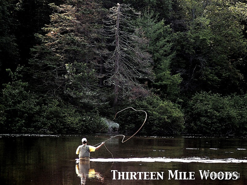
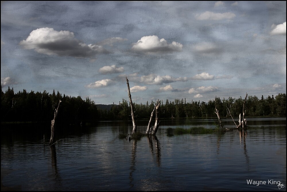
Birch on Stinson Brook
Purchase framed image or prints

The AMC 130 Years of Protecting Our Natural Resources

130 Years of Protecting Our Natural Resources
By Peggy Rosen

Land, air, water, flora and fauna - Since 1876 the Appalachian Mountain Club (AMC) has promoted the protection, enjoyment and wise use of the Appalachian region. Its conservation concerns range from large to small, from seemingly obscure projects to those in the forefront of the community consciousness.

Ever heard of Potentilla robbinsiana (a.k.a. dwarf mountain cinquefoil)? If you want to find this tiny, rosette-shaped plant with its hairy, tooth-like leaves and showy yellow flowers, you have to trek to the heights of New Hampshire. This particular variety of cinquefoil is extremely rare. It only grows in several locations in New Hampshire’s Alpine Zone, above elevations of 4,500 feet.

Discovered by scientists in 1824, this rare jewel of the Granite State was placed on the endangered species list in 1980. Its population had precipitously declined due to over-collection, hiker trampling, and its difficulty in adapting to certain challenges of the harsh alpine environment. Concerned about possible extinction, the AMC, in partnership with the New Hampshire Fish and Wildlife Service and the New England Wildflower Society (NEWFS), put together a rescue and recovery plan. The AMC studied the plant’s biology and collected seeds, which the NEWFS grew and replanted to establish new colonies. The AMC relocated hiking trails and conducted ongoing educational programs for visitors who might travel in cinquefoil-populated areas. The species recovered and was removed from the list in 2002.

If you take a walk in Piscataquog River Park west of Manchester along the railroad spur up to Goffstown, you will encounter an area of pine barren. Very little pine barren habitat is left in New Hampshire, most of it having been cleared or paved. New Hampshire’s official state butterfly, the Karner blue butterfly (also on the federal endangered species list), relies on pine barren habitat, as the caterpillar feeds only on wild lupine, which grows only in pine barren areas. Once thought to be extirpated from New Hampshire, the Karner blues are making a comeback. However, invasive plant species such as Norway maple, bittersweet and garlic mustard threaten to overrun the native plants of Piscataquog Park and make it potentially inhospitable to Karner blue butterflies. AMC members from the New Hampshire Chapter have volunteered their time to clear away some of the invaders, in hopes of restoring the natural balance of this small, but important, piece of the state.

If you gaze out from one of New Hampshire’s many vistas, you may see for miles across peaks, forests, lakes and rivers. But you may just as easily have to squint through a soupy haze shrouding the summits and blanketing the valleys. Decreasing visibility and evidence of Northeast pollution from mid-Western power plants and vehicle emissions has prompted the AMC to take action. AMC members called Visibility Volunteers, or Viz Vols, carry a simple kit on hikes which measures ozone levels and records visibility levels. Viz Vol data collection is part of the Mountain Watch Program, finishing its second season in the autumn of 2005. More than 200 volunteers have submitted reports from around the region. Volunteers can also observe and report seasonal changes in wildflowers and leaf colors. These hikers tracking trends contribute to a large AMC database, which is used in Club air quality advocacy work. The AMC makes recommendations to government agencies and partners with other clean air advocacy groups. Together they are creating a collective voice calling for clean air legislation, policies and procedures.

As a non-profit organization with almost 90,000 members (nearly 10,000 in the New Hampshire Chapter), 130 staff and a dozen chapters throughout mid-Atlantic and Northeastern states, the AMC is well-positioned to make the most of the influence of a large group and the commitment of its individual members to fulfill its mission. The founding members, many of whom were Boston academics who enjoyed the superb recreational opportunities of New Hampshire’s wild areas, recognized the need to protect wilderness. In addition to organizing recreational Club outings, they developed an attitude of stewardship of the land.

As far back as the early 1900’s, AMC members were vitally involved in fulfilling a mission of preservation, addressing lawmakers and policy-makers on the issues of land conservation. At that time there were no National Forests in the Northeast. Working determinedly for almost ten years, pushing for public access to large tracts of wilderness, the group’s efforts were finally rewarded by passage of the Weeks Act of 1911, which allowed the government to purchase private land for the establishment of National Forests. The creation of the White Mountain National Forest followed soon after.

Working with government representatives on conservation continues to be a focus of the AMC. Members are encouraged to seek natural resource protection through the legislature by contacting their representatives and voicing their views, concerns and suggestions. Since 1998, members have been able to keep up-to-date on current conservation issues through the AMC Conservation Action Network.

The recent release of the U.S. Forest Service’s White Mountain National Forest Management Plan provides an example of AMC involvement in policy-making. The new plan, which describes how the WMNF will be managed for the next ten to fifteen years, required the Forest Service to spend years studying data, holding public hearings, sifting through thousands of public comments and drafting many revisions. Throughout this process the AMC submitted written and verbal comments, scientific data, proposals, suggestions and general input. The AMC vision for collaboration, balanced approach to wise use and decades of outdoor expertise provided a solid platform for its recommendations, many of which were adopted as part of the final management plan

Early conservation efforts were also focused on the creation and maintenance of well-thought-out trails for hikers and skiers. Well-routed and maintained trails preserve plant life and minimize the detrimental effects of erosion. In-the-field trail work is still central to AMC conservation. With 325 miles of New Hampshire trails maintained by the group, trail work days are a common activity and are attended by all ages and all abilities. It’s not unusual to encounter a grinning, clipper-wielding seven-year-old on a trail crew, or dirt-smudged teenagers sweating alongside a senior AMC member. The NH Chapter has specific responsibility for maintaining the OLD Bridle Path in Franconia Notch, the Monadnock-Sunapee Greenway and the hiking and ski trails around Cardigan Lodge. The Adopt-A-Trail program, begun in 1980, allows individuals or groups to assume responsibility for specific sections of trail, committing at least two weekends per year to caring for that section. In New Hampshire, 35,000 hours of trail work is provided by staff and volunteers annually.

Roll-up-your-shirtsleeves work sessions, whether involving paperwork or trail work, isn't the only place you'll find AMC-ers. Simply enjoying nature is still an integral part of the AMC experience. Hundreds of all types of activities are available throughout the four seasons for every level of outdoor enthusiast. Trips range from easy family hikes to arduous mountaineering rock and ice climbs, backcountry ski expeditions, multi-day summer backpacking excursions, cycling, paddling, birding, map and compass workshops and wilderness first aid courses.

In addition to the fun of getting together with like-minded folks, the AMC philosophy sees every activity as an opportunity for learning. Trip leaders often impart important ecological knowledge. AMC huts and facilities offer seminars, workshops, displays, and self-directed learning activities that present the natural world, man’s impact on it and our responsibility in trying to protect it. Signs in the restrooms of AMC facilities instruct on water conservation. Wall displays in the halls of The Highland Center in Crawford Notch describe weather patterns, growing seasons, the development and path of acid rain, the inter-dependence of the animals and plants of the forest, and the fragility of the organisms of the Alpine Zone. Families join a naturalist for a walk along a woodland path and stop to study the tiny water life in an adjacent pond. A Mountain Classroom tailors outdoor experiences to middle school and high school students. Some AMC members have received official training in the “Leave No Trace” program, instructing backcountry travelers in low-impact principles. The educational component of AMC activities and facilities attempts to foster a sense of individual responsibility and the realization of what we can all accomplish together.

Striving for a strong and healthy future for New Hampshire’s natural resources, the AMC has “walked the talk,“ in many cases literally, for many decades and countless miles. As one member put it, "the AMC does a lot of good!"

AMC Website


Thirteen Mile Woods Poster

Fishing Along the Thirteen Mile Woods - Errol to Milan, NH

Thirteen Mile Woods Poster

The Great North Woods area of New Hampshire features some of the best fishing and canoeing in the state, including the Thirteen Mile Woods area along the Androscoggin River.

The terrain varies from peaceful meandering stretches of river through boreal forest to the wild rapids of Pontook and the great spots just below several dams along the river.

If you are a fisher who enjoys the early morning hours or the quiet moments around dusk, you are likely to find yourself sharing the river now and then with a moose or a pair of nesting loons.

Depending upon your choice of overnight accomodations your choices range just as broadly from camping at the small and friendly Molligiwock State Campground to "roughing it" at the Balsams, one of New Hampshire's premier resort hotels.


The Thirteen Mile Woods begins just north of New Hampshire's largest northern City, Berlin (pronounced "Burl'n" if you want to talk like a native). Your experience won't just be a few hours of fishing. It will be a trip back into history as well. You'll notice, for one thing, a lot of submerged logs along the river. The Androscoggin River was used for many years to run logs from the forests along and above the Thirteen Miles Woods down to the mills in Berlin. Large formations of rock and logs line the midcourse of the river just north of Berlin.

Painted Skies Over Umbagog
The Rock Crib Piers in the Androscoggin River were built by the Berlin Mills so they could store the logs until they were needed. The piers were connected by log booms, connected end to end and also by log booms from each pier to the shore line. This created a series of storage areas and as the Mill called for logs, the boom was opened on the downstream side so the logs simply floated to the dam just north of the present day paper mill. From there the logs were taken out of the water, and sent into the mill. At one time, this was done via a steam powered conveyor system.

The rock piers were built in the wintertime. They waited for the ice to form so they could drag the rocks and logs out to the middle of the river. They were then placed in the proper place, and then the ice was cut around the rock pile, then the rocks settled to the bottom. It took many repeats of the process to get the rock islands up to water level, then the rock crib was formed and the balance of the rocks were placed.

You will also undoubtedly share the river with canoeists and kayakers as this river has the best year-round whitewater paddling in all of New Hampshire.

If you visit the Thirteen Mile Woods area, you will also want to make a few sidetrips to see Lake Umbagog one of the most pristine lakes in New Hampshire. In fact you may decide that you want to make your trip a multi-day combination canoe and fishing trip. If so you have lots of choices.

Pale Lilies in a Platinum Storm